|
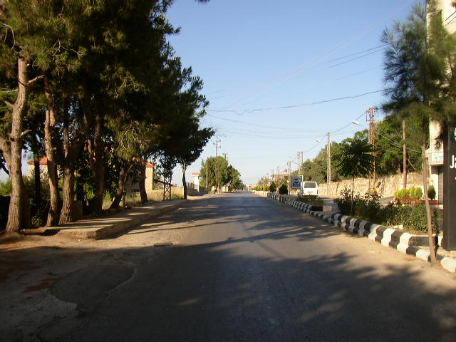
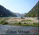
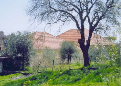
Marjayoun, Lebanon
Marjayoun more properly "Jedaidat
Marjayoun" is famous as the place of origin of many distinguished Lebanese
emigrants and their families, such as the first jet ace, Major James Jabara,
of Korean war frame, and for Mrs. Kerr's Self Help Center. It is important
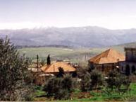
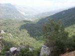
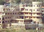
locally as the largest Lebanese town of the South Beqaa and as the district
headquarters, as well as being the market center of the region. It has
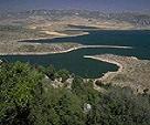
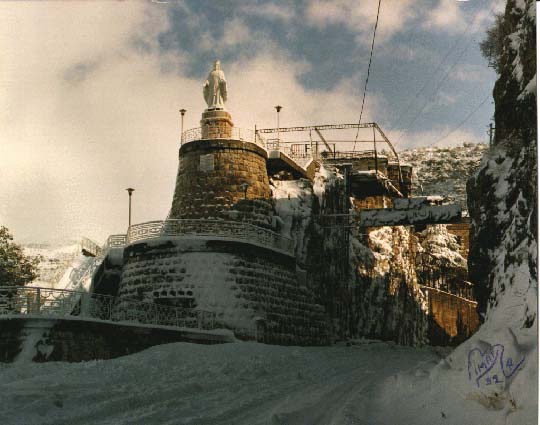
always been an army garrison town, guarding the nearby (8 kms) Palestinian
frontier, and being in a commanding position on its hillside, provides many
scenic views of the surrounding countryside.
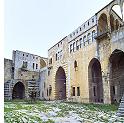
But that it also holds interesting
antiquities is generally unknown.
The name itself may come from the
ancient lost city of Iyyon by later confusion with ayoun, the Arabic plural for
"spring". "Marj" of course is simply "plain", thus "Plain of the Springs". The
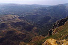
plain proper extends south from the present town to the Palestinian frontier and
is surrounded on three sides by hills. Near the north end of the plain and less
than two kilometers below the town is Tell Debbin, thought to be the actual site
of the lost Iyyon.
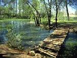
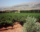
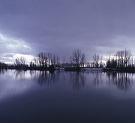
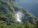
The town owes its name to a large
number of water sources and springs forming small rivers, which made the
surrounding plain very fertile.
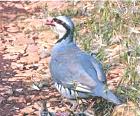
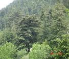
It has a wide variety of trees and
is famous for its beautiful landscape and mild climate. The most important
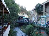
source is the al Dardarah spring to the east, near al Khiam not far from the
southern Lebanese border. This is surrounded by outdoor restaurants serving
Lebanese food. Several banks, hotels and hospitals are found in Jdeidet
Marjayoun. In its vicinity, the tourist can visit many archeological sites,
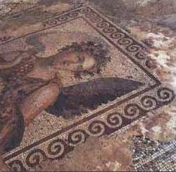
such as Al Shqif, Tell Dibbin (where you can still find ancient tombs) and
Hasbaya. Near Dibbin is the mausoleum of Nabi Hizine.
Marjayoun
Neighborhood
Three kilometers north of
Marjayoun is the mausoleum of the prophet Ezekiel, a holy shrine visited by
believers seeking the prophet’s blessing. Eight kilometers east of Jdeidet
Marjayoun lies the village of Ibl al Saqi, famous for its beautiful houses
and the springs that made the agricultural development of the village
possible. Before the war, local authorities opened the so-called “Farmer’s
house,” an institution aiming at raising the living standard of the
peasants. A cultural and social club contributed to this project by creating
workshops for traditional handicrafts.
South of Ibl al Saqi lies al
Khiam, a fairly big town with houses built on a hill overlooking the plain
of Marjayoun. The al Dardarah spring bursts out west of the locality
and irrigates its fields and orchards.
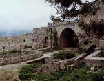
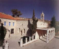
Near Qlayya south of Marjayoun
is an old monastery known as Qedissa Hanni which stands on a high hill
visible from the road. The huge structure, with its own underground stables,
is in ruin with the exception of a small chapel installed in 1993. You
then reach Adayse and Mays al Jabal where you can visit an old Mosque said
to belong to one of the Prophet’s companions, Abi Zor al ghafari. In Blida
(30 km), there is an 18th century mosque with an old well. Below Blida
village are three old springs, now covered, around which many legends are
told.
Further south is the village of
Kfar Kila and the important mausoleum and shrine of Nabi Khodor who is
related to Mar Jurious (St. George).
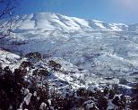
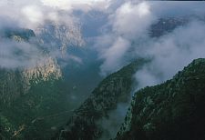
South Lebanon is the region
extending from the Awali river in the North to Ras El Naqoura in the South and
from the Mediterranean sea in the west to the Syro-Lebanese borders in the East.
Towns and villages of the mountain area lie at an altitude of 800 to 1500m.
In Mount Niha are the most famous summer resorts of South Lebanon: Jezzine,
Kfarhouna, Roum, Aramta, Bkassine, Jbaa, Jarjou and Arab Salim.
East of the coastal plains, rise the hills which form the largest part of South
Lebanon. Their altitude steadily increases to reach 1000m. They are
watered by the Qasmieh River (Litani) and covered with olive, apple, almond,
pine and oak trees.
Information From the Ministry of Tourism
| 


 Lebanon - Marjayoun